


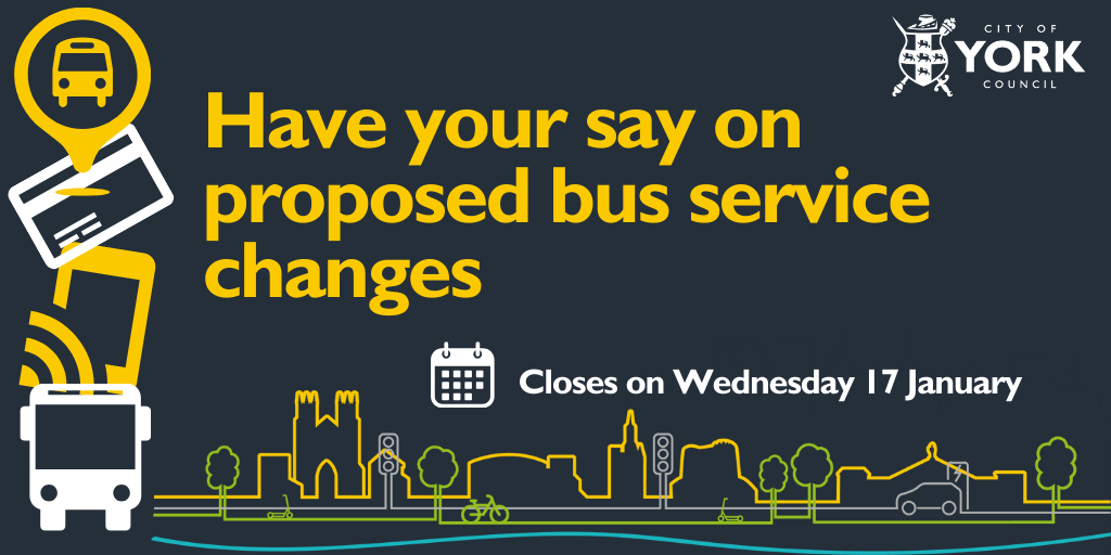
Key bus services that serve local communities in York are being reviewed and consulted on by City of York Council, to ensure support can continue longer-term.
Bus users are encouraged to have their say on the review at www.york.gov.uk/consultations until Wednesday 17 January 2024.
During the consultation, Paper copies of the consultation are available at all local libraries in York. Paper copies can be sent back via this freepost address: Bus Review Consultation, RTEG-TYYU-KLTZ, City of York Council, West Offices, Station Rise, York, YO1 6GA
They are also available in alternative formats such as braille or large print by emailing cycaccessteam@york.gov.uk, or contacting Customer Services on telephone on 01904 551550.
Drop-in sessions are also being held at Friargate on Monday 8 January (2pm -5pm) and Wednesday 10 January (2pm -7pm) – on the back of the Our Big Transport Conversation
The proposals will help to ensure that the bus network is more stable and efficient, reflecting post-Covid passenger demand, and that services are more affordable and reliable.
The review has taken account of how well services are currently used. One of the outcomes of the review is that only services with an average of at least 8 passengers per bus hour continue to be subsidised.
In recognition of the social value to outlying villages, relatively high operating costs and smaller passenger base, rural bus services with daytime departures every 2 hours or less will receive a greater level of subsidy, of up to £6.80 per passenger, if services are at risk.
Hourly or better services, including those in urban areas of the city, will only be eligible for support if they have an ongoing cost to the council of no more than £3.40 per passenger.
It is estimated the proposals will deliver around £200k of savings in 2024/25, which will help offset overall rising bus operating costs.
Cllr Pete Kilbane, Executive Member for Economy and Transport, said: “We recognise these proposed changes would impact on residents’ daily lives, so it’s important to us that we hear feedback and are able to reflect this in the final proposals. These changes seek to deliver an affordable, efficient and stable bus network, enabling bus patronage to grow and services to become financially sustainable.
“But this comes with a stark warning that if the government does not provide longer term funding support, or bus usage doesn’t increase – further services may be impacted in future. The BSIP funding we have provides only short term relief to the ongoing pressures facing bus operations.”
The service changes proposed, include:
Service 1
It is proposed to withdraw support for journeys with very low usage and high cost-per-passenger, specifically the journeys timed at 22:32, 23:17 and 23:19 Sunday evening journeys on service 1, and potentially the pre-06:00 Monday to Saturday journeys.
A map showing the service 1 route can be viewed on First’s website at www.firstbus.co.uk/uploads/maps/1%20York%20Map_A5.pdf
Service 11
It is proposed that all service 11 journeys will operate via the South Bank loop. In addition, it is proposed that the service frequency will reduce from every 50 minutes to an hourly service.
In parallel with this change, it is proposed to remove the service 26 South Bank loop (more details below).
A map showing the current service 11 route can be viewed on First’s website at www.firstbus.co.uk/uploads/maps/11%20York%20Map%20%28A5%29.pdf
The proposed changes to service 11 will result in the South Bank part of the route (currently labelled ‘evening journeys only’ on the above map) instead being operated throughout the day.
Services 12 and 14
It is proposed to merge services 12 and 14 into one contract to offer a more efficient service, and better value for money. No overall service frequency reduction is anticipated and all stops will continue to be served, however minor timetable changes would be required to interwork the two timetables.
A description of the current route 12 can be found below.
A map showing the current service 14 route can be viewed on Transdev’s website at www.transdevbus.co.uk/york/services/YCD/14.
Service 13
The majority of the route currently taken by the number 13 will remain the same.
It is proposed that the Flaxman Croft loop, Copmanthorpe section of the Monday to Friday services will be withdrawn. This will result in an additional walking distance from this are to the nearest bus service of up to 650 metres.
It is also proposed that West Nooks, Haxby is served by an hourly variation of service 1 (proposed to be numbered 1A) rather than the half hourly service 13.
A description of the current weekday route 13 can be found below.
A description of the proposed route 1A and weekday route 13 can also be found below.
Services 16 and 24
It is proposed that bus service 16 is retendered as a longer, hourly route, taking in the Ascot Way loop from service 24. This proposal would reduce the frequency of service 16 from every 45 mins to every hour. There would also be a loss of the direct link from Poppleton Road to Ascot Way, with a change required in Acomb.
A description of the current and proposed routes for service 16 can be found below.
The current service 24 routes can be viewed on Transdev’s website at www.transdevbus.co.uk/york/services/YCD/24
Service 19
An hourly Monday-Saturday service is proposed. This would result in a reduction in the current morning frequency from half-hourly to hourly. Priority will be given to maintaining school-time journeys.
The proposed changes will only affect the frequency of service 19 and will have no impact on the routings.
Services 24/25/26
It is proposed that the contract for services 24, 25, and 26 will be retendered to provide an hourly service to Acomb & Derwenthorpe and a half-hourly service to Fulford Crossfield Crescent & Germany Beck. The proposed new service numbers are:
24 - Fulford-Acomb (incorporating half of the current route 26 and the current route 24 as far as Acomb shops)
25 - Fulford-Derwenthorpe (route unchanged)
This proposal will result in the loss of a direct link in one direction from Fulford to South Bank. (Note, it is already not possible to make an unbroken bus journey in the other direction, from South Bank to Fulford).
The current routes of services 24, 26 and 26 can be viewed on Transdev’s website using the following links:
24 - www.transdevbus.co.uk/york/services/YCD/24
25 - www.transdevbus.co.uk/york/services/YCD/25
26 - www.transdevbus.co.uk/york/services/YCD/26
Service 26 will be merged with service 24 as above.
No route changes are proposed to service 25, other than serving Germany Beck via the same route as the proposed route 24 (ie. Thornton Rd, Bishopdate Way, Whitting Close, Porter Avenue, Thornton Rd, Fordlands Rd to Crossfield Crescent).
Following a period of consultation, the feedback will be taken to an Executive meeting in late January, with a view to implementing some of the changes at the end of April 2024 and others later in 2024.
A mixture of open tender procurement exercises and de minimis agreements will commence following Executive approval, in order to secure bus operators for these services.
The council strategy to safeguard the local bus network is to encourage users to return to using buses, and the key to ensuring this happens is to maintain as stable, frequent and reliable set of services as possible with the available funding.
Through the Enhanced Bus Partnership we’ll be continuing to work closely with bus operators and stakeholders on how City of York’s Bus Service Improvement Plan (BSIP) funding should be invested to support bus services in the coming years. The Partnership will also be crucial in proactively promoting public transport use across the city to help cut congestion and provide access to jobs and services.
There’s also still time to feedback on the Our Big Transport Conversation to help shape the future of transport across York and its surrounding villages.
For a full list of events, activities and ways to take part, as well as all the materials and questions, see the Our Big Transport Conversation consultation.
----------------
Detailed description of the changes:
SERVICE 12
Description of current route 12:
Monks Cross – York – Woodthorpe - Foxwood Lane
From Monks Cross Drive via bus only road inside Monks Cross Shopping Park, Jockey Lane, New Lane, Malton Road, Elmfield Avenue, Monkton Road, Byland Avenue, Huntington Road, Fossway, Dodsworth Avenue, Heworth Green, Foss Bank, Peasholme Green, Stonebow, Coppergate, Nessgate, Low Ousegate, Bridge Street, Micklegate, George Hudson St, Rougier St, Station Road, Queen St, Blossom St, The Mount, Mount Vale, Tadcaster Road, Askham Bar Tesco internal road, Moor Lane, Alness Drive, Acomb Wood Drive, Bellhouse Way (eastbound), Foxwood Lane, Bellhouse Way, Acomb Wood Drive, Alness Drive, Moor Lane, Moorcroft Rd to Woodthorpe shops.
Foxwood Lane – Woodthorpe – York – Monks Cross
From Woodthorpe shops via Acorn Way, Ryecroft Avenue, Grassholme, Moor Lane, Askham Bar Tesco internal road, Tadcaster Road, Mount Vale, The Mount, Blossom St, Queen St, Station Road, Station Avenue, Rougier St, George Hudson St, Micklegate, Low Ousegate, Clifford St, Tower St, Piccadilly, Stonebow, Peasholme Green, Jewbury, St Maurice’s Road, Monkgate, Heworth Green, Dodsworth Avenue, Fossway, Huntington Road, Byland Avenue, Monkton Road, Elmfield Avenue, Malton Road, New Lane, Jockey Lane to Monks Cross Drive.
SERVICE 13 (and proposed 1A)
Description of current weekday route 13:
Copmanthorpe – York – Haxby (West Nooks)
From Station Rd (Copmanthorpe) via Main St (Copmanthorpe), Horseman Lane, Top Lane, Merchant Way, Flaxman Croft, Merchant Way, Top Lane, Tadcaster Rd (Copmanthorpe), A1036 Tadcaster Rd, Askham Bar Tesco, Tadcaster Rd (Dringhouses), Mount Vale, The Mount, Blossom St, Queen St, Station Rd (York Rail Station), Station Ave, Rougier St, George Hudson St, Micklegate, Bridge St, Low Ousegate, Nessgate, Clifford St, Tower St, Piccadilly, Pavement, The Stonebow, Peasholme Green, Jewbury, St Maurice’s Rd, Monkgate, Huntington Rd, Haley’s Terrace, Haxby Rd, Hawthorne Terrace, Haxby Rd (New Earswick), York Rd (Haxby), Station Rd (Haxby), Towthorpe Rd to West Nooks (Haxby).
Haxby (West Nooks) – York – Copmanthorpe
West Nooks (Haxby) via Towthorpe Rd, Station Rd (Haxby), The Village (Haxby), Westfield Rd, Greenshaw Drive, Wheatfield Lane, Eastfield Avenue, York Rd (Haxby), Haxby Rd (New Earswick), Hawthorne Terrace, Haxby Rd, Haley’s Terrace, Huntington Rd, Foss Bank, Peasholme Green, The Stonebow, Pavement, Coppergate, Nessgate, Low Ousegate, Bridge St, Micklegate, George Hudson St, Rougier St, Station Rd (Grand Hotel), Station Rise, Station Rd (York Station), Queen St, Blossom St, The Mount, Mount Vale, Tadcaster Rd (Dringhouses), Askham Bar Tesco, A1036 Tadcaster Rd, Tadcaster Rd (Copmanthorpe), Top Lane, Horseman Lane, St Giles Way to Station Rd (Copmanthorpe).
Description of proposed weekday route 13:
Copmanthorpe – York – Haxby (West Nooks)
From Station Rd (Copmanthorpe) via Main St (Copmanthorpe), Horseman Lane, Top Lane, Tadcaster Rd (Copmanthorpe), A1036 Tadcaster Rd, Askham Bar Tesco, Tadcaster Rd (Dringhouses), Mount Vale, The Mount, Blossom St, Queen St, Station Rd (York Rail Station), Station Ave, Rougier St, George Hudson St, Micklegate, Bridge St, Low Ousegate, Nessgate, Clifford St, Tower St, Piccadilly, Pavement, The Stonebow, Peasholme Green, Jewbury, St Maurice’s Rd, Monkgate, Huntington Rd, Haley’s Terrace, Haxby Rd, Hawthorne Terrace, Haxby Rd (New Earswick), York Rd (Haxby) to The Village (Haxby).
Haxby (West Nooks) – York – Copmanthorpe
From The Village (Haxby) via Westfield Rd, Greenshaw Drive, Wheatfield Lane, Eastfield Avenue, York Rd (Haxby), Haxby Rd (New Earswick), Hawthorne Terrace, Haxby Rd, Haley’s Terrace, Huntington Rd, Foss Bank, Peasholme Green, The Stonebow, Pavement, Coppergate, Nessgate, Low Ousegate, Bridge St, Micklegate, George Hudson St, Rougier St, Station Rd (Grand Hotel), Station Rise, Station Rd (York Station), Queen St, Blossom St, The Mount, Mount Vale, Tadcaster Rd (Dringhouses), Askham Bar Tesco, A1036 Tadcaster Rd, Tadcaster Rd (Copmanthorpe), Top Lane, Horseman Lane, St Giles Way to Station Rd (Copmanthorpe).
Description of proposed route 1A:
York - Haxby (West Nooks)
From Station Rd (York Rail Station) via Museum St, St Leonard’s Place, Gillygate, Clarence St, Haxby Rd, Hawthorne Terrace, Haxby Rd (New Earswick), York Rd (Haxby), Eastfield Avenue, Oak Tree Lane, Holly Tree Lane, York Rd, Station Rd (Haxby), Towthorpe Rd to West Nooks (Haxby).
Haxby (West Nooks) – York
From West Nooks (Haxby) via Towthorpe Rd, Station Rd (Haxby), York Rd (Haxby), Holly Tree Lane, Oak Tree Lane, Eastfield Avenue, York Rd (Haxby), Haxby Rd (New Earswick), Hawthorne Terrace, Haxby Rd, Clarence St, Gillygate, St Leonard’s Place, Museum St to Station Rd (York Rail Station).
SERVICE 16
Description of current route 16:
York – Acomb via Holly Bank Rd
From Piccadilly via Coppergate, Nessgate, Low Ousegate, Bridge Street, Micklegate, George Hudson Street, Rougier Street, Station Road, Station Rise, Station Road, Queen Street, Blossom Street, Holgate Road, Hamilton Drive East, Holly Bank Road, Hob Moor Drive, Collingwood Avenue, Hamilton Drive, Hamilton Drive West, Green Lane (Acomb).
Acomb – York via Holly Bank Rd
From Green Lane (Acomb) via Hamilton Drive West, Hamilton Drive, Collingwood Avenue, Hob Moor Drive, Holly Bank Road, Hamilton Drive East, Holgate Road, Blossom Street, Queen Street, Station Road, Station Avenue, Rougier Street, George Hudson Street, Micklegate, Bridge Street, Low Ousegate, Nessgate, Coppergate, Piccadilly, Merchantgate.
Description of proposed route 16:
York – Holly Bank Rd – Acomb – Ascot Way
As above to Green Lane (Acomb), then via Front St, Gale Lane, Tudor Rd, Stuart Rd, Danesfort Ave, Kingsway West to Ascot Way.
Ascot Way - Acomb – Holly Bank Rd – York
From Ascot Way via Ashford Place, Windsor Garth, Kingsway West, Danesfort Ave, Gale Lane, St Stephen’s Rd, Cornlands Rd, Askham Lane, Front St, Green Lane (Acomb), then as above to Piccadilly.
SERVICE 19
A description of current route 19:
Skelton - York
From Brecksfield, Skelton, via Fairfields Drive, A19 Shipton Rd, Howard Drive, Shipton Rd (service road adjacent to The Mitre), Bowness Drive, Eastholme Drive, Green Lane, Water Lane, Rawcliffe Drive, Rawcliffe Lane, Brompton Road, Water Lane, Burdyke Avenue, Crichton Avenue, Burton Stone Lane, A19 Clifton, Clifton Green, Water End, Salisbury Road, Salisbury Terrace, Kingsland Terrace, Leeman Road, Station Rise, A1036 Station Avenue, A1036 Museum Street, A1036 St Leonard's Place to Exhibition Square.
York - Skelton
From Exhibition Square via A19 Bootham, Burton Stone Lane, Crichton Avenue, Burdyke Avenue, Water Lane, Brompton Road, Rawcliffe Lane, Rawcliffe Drive, Water Lane, Green Lane, Eastholme Drive, Howard Drive, A19 Shipton Road, St Giles Road, The Village (Skelton), Brecksfield (Skelton).
A description of the current route 19A (afternoon variation to maintain timetable during congested PM peak period):
Skelton - York
From Brecksfield, Skelton as per route 19 to Eastholme Drive then Rawcliffe Lane, Rawcliffe Drive (serving stops in opposite direction to 19), Water Lane,
then as per route 19 from Burdyke Avenue.
York-Skelton
From Exhibition Square as per route 19 to Burdyke Avenue then Water Lane, Rawcliffe Drive (serving stops in opposite direction to 19), Rawcliffe Lane, then as per route 19 from Eastholme Drive.
A description of the current route 19X (early morning variation to return to Skelton quickly):
York - Skelton
From Exhibition Square via Bootham, Clifton, Shipton Rd, St Giles Rd, The Village (Skelton), Brecksfield (Skelton).
SERVICE 24
A description of the proposed route 24:
Fulford – York – Acomb
From Crossfield Crescent via Fordlands Rd, Thornton Rd, Bishopdate Way, Whitting Close, Porter Avenue, Thornton Rd, Main St (Fulford), Heslington Lane, Broadway, Fulford Rd, Fishergate, Tower St, Piccadilly, Coppergate, Nessgate, Low Ousegate, Micklegate, George Hudson St, Rougier St, Station Rd (Grand Hotel), Station Rise, Station Rd (York Rail Station), Queen St, Blossom St, Holgate Rd, Poppleton Rd, Grantham Drive, Howe Hill Close, Sowerby Rd, Lindsey Ave, Boroughbridge Rd, Carr Lane to York Rd (Acomb Shops).
Acomb – York – Fulford
From York Rd (Acomb Shops) via Carr Lane, Boroughbridge Rd, Poppleton Rd, Grantham Drive, Howe Hill Close, Sowerby Rd, Lindsey Ave, Poppleton Rd, Holgate Rd, Blossom St, Queen St, Station Rd (York Rail Station), Station Avenue, Rougier St, George Hudson St, Micklegate, Low Ousegate, Nessgate, Clifford St, Tower St, Piccadilly, Merchantgate, Walmgate, St Deny’s Rd, Piccadilly, Paragon St, Fawcett St, Fishergate, Fulford Rd, Broadway, Heslington Lane, Main St (Fulford), Thornton Rd, Bishopdate Way, Whitting Close, Porter Avenue, Thornton Rd, Fordlands Rd to Crossfield Crescent.
 New Community Diagnostic Centre opens in York
 Yorkshire Water starts work on £1.3 million investment in Ellerton
 York College Alumnus Lisa Parkinson receives BAFTA to add to collection of awards
 NHS booking system open for spring COVID-19 vaccinations
 Mass flowering is recorded at Yorkshire Wildlife Trust’s York Site